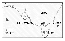
Forecasts may be generated for 56 localities, including
all localities shown on the map except for Fawkner Beacon
and St Kilda Harbour RMYS.
Link
to BMRC 6 October 2005 Paper
Link
to BMRC 6 Oct 2005 Presentation
Link
to AMS 30 January 2006 Paper
Link
to Update of AMS 30 January 2006 Paper
Link
to AMS 30 January 2006 Presentation
Link
to paper submitted to Australian Meteorological Magazine
Link
to NOAA NWP Model Link
to Optimal Consensus Forecast
Link
to Official Melbourne City Forecast Link
to Melbourne Aerodrome (YMML) Forecast Link to Hourly Melbourne City Observations Link to Daily Melbourne City Observations Link
to Current Melbourne Region Observations Link to 3pm Weather Bulletin Link to Notes on the Weather Link to Central District Forecast Link to West Gipsland District Forecast
The Weather Icons
Acknowledgement: Bureau of Meteorology & World Meteorological Organisation
Sunny
Dry
Haze
Mist
Fog
Partly Cloudy
Cloudy
Windy
Dust
Possible Shower
Drizzle
Shower
Snow
Rain
Thunder
Cyclone
Definitions
Icon
Meaning
Sunny:
Sun shines >75% of the time
Dry:
As 'sunny', but used on days when Max > 30 Deg C & Relative Humidity drops below 10%
Haze:
As 'sunny', but used on days when visibility drops below 5 km due to smoke
Mist:
Visibility below 5000 m due to water droplets but above 400 m
Fog:
Visibility below 400 m
Partly Cloudy:
Sun shines between 25% & 75% of the time
Cloudy:
Sun shines <25% of the time
Windy:
No precipitation & wind speed averages 'fresh' (18 kts) or stronger
Dust:
Visibility <1km due to dust raised by wind
Possible Shower:
Isolated light precipitation <25% of the metropolitan area
Drizzle:
Liquid precipitation that is almost continuous & made up of fine droplets
Shower:
Brief periods of liquid precipitation
Snow:
Snow or sleet falls (includes cases of flurries and/or ice)
Rain:
Liquid precipitation that is almost continuous but droplets are of medium size or large (not fine)
Thunder:
Thunder heard or lightning seen
Cyclone:
Wind speed averages 'storm force' (60 kts) or stronger