Enter Locality (Refer to Map):
Locality:
Avalon
Bundoora
Cerberus
Coldstream
Cranbourne
Dunns Hill
Essendon
Frankston
Geelong
Laverton
Melbourne
Melbourne Ap
Moorabbin
Phillip Island
Point Wilson
Rhyll
Scoresby
Sheoaks
South Channel Island
Viewbank
Wonthaggi
Enter NWP Model Base Time (Victorian Local Time):
Time:
Midnight
1am
2am
3am
4am
5am
6am
7am
8am
9am
10am
11am
Noon
1pm
2pm
3pm
4pm
5pm
6pm
7pm
8pm
9pm
10pm
11pm
Date:
1
2
3
4
5
6
7
8
9
10
11
12
13
14
15
16
17
18
19
20
21
22
23
24
25
26
27
28
29
30
31
Month:
Jan
Feb
Mar
Apr
May
Jun
Jul
Aug
Sep
Oct
Nov
Dec
Year:
2005
2006
2007
2008
2009
2010
previously forecast
Date:
1
2
3
4
5
6
7
8
9
10
11
12
13
14
15
16
17
18
19
20
21
22
23
24
25
26
27
28
29
30
31
Month:
1
2
3
4
5
6
7
8
9
10
11
12
Year:
2005
2006
2007
2008
2009
2010
Day:
Sun
Mon
Tue
Wed
Thu
Fri
Sat
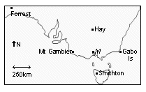
Melbourne MSL:
Hay MSL:
Smithton MSL:
Gabo Is MSL:
Mt Gambier MSL:
Forrest MSL:
Melbourne 700 hPa % RH:
850 hPa Temp:
Day Zero Min (18 h to 9am):
Day Zero 9am Temp:
Day Zero 12noon Temp:
Day Zero 3pm Temp:
Day Zero 3pm Dew Point Temp:
Day 1 Min Previously Forecast:
Day 1 Max Previously Forecast:
Day 1 Precip Amount Previously Forecast:
Day 1 Precip Prob Previously Forecast:
Day 1 GFS Precip Forecast (24h to 12UTC):
Day 1 Official Min Forecast:
Day 1 Official Max Forecast:
Day 1 Official Precis Forecast (use upper case and no punctuation):
Day 1 Official 9am Wind Direction Forecast (VRB, NNE, NE, ENE, E ... NNW, N):
Day 1 Official 9am Wind Speed Forecast (km/hr):
Day 1 Official 3pm Wind Direction Forecast (VRB, NNE, NE, ENE, E ... NNW, N):
Day 1 Official 3pm Wind Speed Forecast (km/hr):
previously forecast
Date:
1
2
3
4
5
6
7
8
9
10
11
12
13
14
15
16
17
18
19
20
21
22
23
24
25
26
27
28
29
30
31
Month:
1
2
3
4
5
6
7
8
9
10
11
12
Year:
2005
2006
2007
2008
2009
2010
Day:
Sun
Mon
Tue
Wed
Thu
Fri
Sat
Melbourne MSL:
Hay MSL:
Smithton MSL:
Gabo Is MSL:
Mt Gambier MSL:
Forrest MSL:
Melbourne 700 hPa % RH:
850 hPa Temp:
Min Previously Forecast:
Max Previously Forecast:
Precip Amount Previously Forecast:
Precip Prob Previously Forecast:
Day 2 GFS Precip Forecast (24h to 12UTC):
Day 2 Official Min Forecast:
Day 2 Official Max Forecast:
Day 2 Official Precis Forecast (use upper case and no punctuation):
previously forecast
Date:
1
2
3
4
5
6
7
8
9
10
11
12
13
14
15
16
17
18
19
20
21
22
23
24
25
26
27
28
29
30
31
Month:
1
2
3
4
5
6
7
8
9
10
11
12
Year:
2005
2006
2007
2008
2009
2010
Day:
Sun
Mon
Tue
Wed
Thu
Fri
Sat
Melbourne MSL:
Hay MSL:
Smithton MSL:
Gabo Is MSL:
Mt Gambier MSL:
Forrest MSL:
Melbourne 700 hPa % RH:
850 hPa Temp:
Min Previously Forecast:
Max Previously Forecast:
Precip Amount Previously Forecast:
Precip Prob Previously Forecast:
Day 3 GFS Precip Forecast (24h to 12UTC):
Day 3 Official Min Forecast:
Day 3 Official Max Forecast:
Day 3 Official Precis Forecast (use upper case and no punctuation):
previously forecast
Date:
1
2
3
4
5
6
7
8
9
10
11
12
13
14
15
16
17
18
19
20
21
22
23
24
25
26
27
28
29
30
31
Month:
1
2
3
4
5
6
7
8
9
10
11
12
Year:
2005
2006
2007
2008
2009
2010
Day:
Sun
Mon
Tue
Wed
Thu
Fri
Sat
Melbourne MSL:
Hay MSL:
Smithton MSL:
Gabo Is MSL:
Mt Gambier MSL:
Forrest MSL:
Melbourne 700 hPa % RH:
850 hPa Temp:
Min Previously Forecast:
Max Previously Forecast:
Precip Amount Previously Forecast:
Precip Prob Previously Forecast:
Day 4 GFS Precip Forecast (24h to 12UTC):
Day 4 Official Min Forecast:
Day 4 Official Max Forecast:
Day 4 Official Precis Forecast (use upper case and no punctuation):
previously forecast
Date:
1
2
3
4
5
6
7
8
9
10
11
12
13
14
15
16
17
18
19
20
21
22
23
24
25
26
27
28
29
30
31
Month:
1
2
3
4
5
6
7
8
9
10
11
12
Year:
2005
2006
2007
2008
2009
2010
Day:
Sun
Mon
Tue
Wed
Thu
Fri
Sat
Melbourne MSL:
Hay MSL:
Smithton MSL:
Gabo Is MSL:
Mt Gambier MSL:
Forrest MSL:
Melbourne 700 hPa % RH:
850 hPa Temp:
Min Previously Forecast:
Max Previously Forecast:
Precip Amount Previously Forecast:
Precip Prob Previously Forecast:
Day 5 GFS Precip Forecast (24h to 12UTC):
Day 5 Official Min Forecast:
Day 5 Official Max Forecast:
Day 5 Official Precis Forecast (use upper case and no punctuation):
previously forecast
Date:
1
2
3
4
5
6
7
8
9
10
11
12
13
14
15
16
17
18
19
20
21
22
23
24
25
26
27
28
29
30
31
Month:
1
2
3
4
5
6
7
8
9
10
11
12
Year:
2005
2006
2007
2008
2009
2010
Day:
Sun
Mon
Tue
Wed
Thu
Fri
Sat
Melbourne MSL:
Hay MSL:
Smithton MSL:
Gabo Is MSL:
Mt Gambier MSL:
Forrest MSL:
Melbourne 700 hPa % RH:
850 hPa Temp:
Min Previously Forecast:
Max Previously Forecast:
Precip Amount Previously Forecast:
Precip Prob Previously Forecast:
Day 6 GFS Precip Forecast (24h to 12UTC):
Day 6 Official Min Forecast:
Day 6 Official Max Forecast:
Day 6 Official Precis Forecast (use upper case and no punctuation):
previously forecast
Date:
1
2
3
4
5
6
7
8
9
10
11
12
13
14
15
16
17
18
19
20
21
22
23
24
25
26
27
28
29
30
31
Month:
1
2
3
4
5
6
7
8
9
10
11
12
Year:
2005
2006
2007
2008
2009
2010
Day:
Sun
Mon
Tue
Wed
Thu
Fri
Sat
Melbourne MSL:
Hay MSL:
Smithton MSL:
Gabo Is MSL:
Mt Gambier MSL:
Forrest MSL:
Melbourne 700 hPa % RH:
850 hPa Temp:
Min Previously Forecast:
Max Previously Forecast:
Precip Amount Previously Forecast:
Precip Prob Previously Forecast:
Day 7 GFS Precip Forecast (24h to 12UTC):
Day 7 Official Min Forecast:
Day 7 Official Max Forecast:
Day 7 Official Precis Forecast (use upper case and no punctuation):
Computed official precip amounts and probs:
Day 1 Amt: Day 2 Amt: Day 3 Amt: Day 4 Amt:
Day 5 Amt: Day 6 Amt: Day 7 Amt:
Day 1 Prob: Day 2 Prob: Day 3 Prob: Day 4 Prob:
Day 5 Prob: Day 6 Prob: Day 7 Prob:
Computed probability of thunderstorms (Prob TS) and probability of fog (Prob Fog):
Day 1 Prob TS: Day 2 Prob TS: Day 3 Prob TS: Day 4 Prob TS:
Day 5 Prob TS: Day 6 Prob TS: Day 7 Prob TS:
Day 1 Prob Fog: Day 2 Prob Fog: Day 3 Prob Fog: Day 4 Prob Fog:
Day 5 Prob Fog: Day 6 Prob Fog: Day 7 Prob Fog:
Now compute the weather graphic HTML code:
Now press the "Submit Query" button to forward the query, the data, and the forecast.